ADAS & Autonomous Vehicles Interview Questions
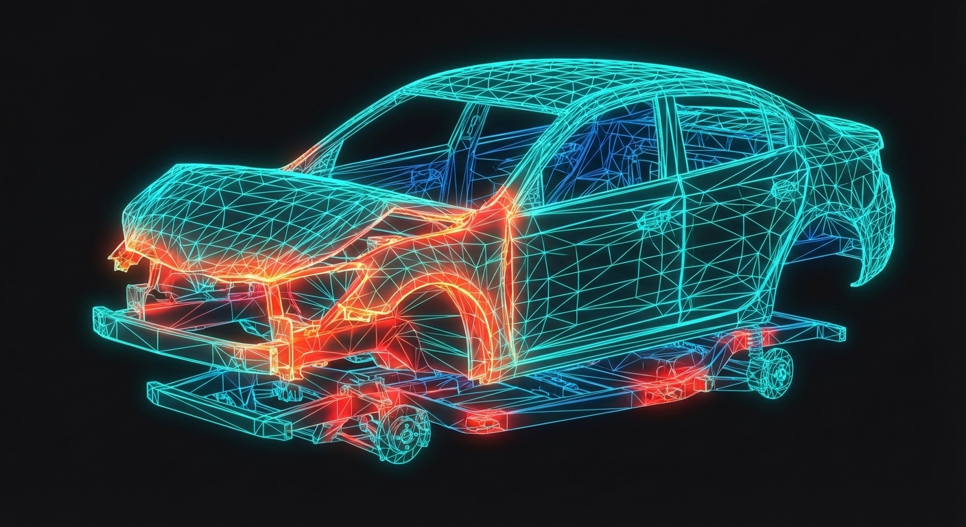
Sensor fusion, perception algorithms, path planning, and vehicle control systems
1 What is ADAS and what are its primary objectives?
Easy
What is ADAS and what are its primary objectives?
ADAS (Advanced Driver Assistance Systems) are electronic systems that assist drivers with driving tasks and enhance safety. Primary objectives include: Reducing human error (cause of >90% of accidents), providing warnings of hazards, automating repetitive or dangerous tasks, and improving overall road safety. Examples include adaptive cruise control, automatic emergency braking, lane keeping assist, and blind spot detection. ADAS uses sensors (cameras, radar, lidar, ultrasonic) to perceive the environment and ECUs to process information and control vehicle functions. ADAS forms the foundation for autonomous driving development.
2 What are the SAE levels of driving automation?
Easy
What are the SAE levels of driving automation?
SAE J3016 defines six automation levels: Level 0 - No automation (driver performs all driving tasks); Level 1 - Driver assistance (system controls either steering OR acceleration/braking); Level 2 - Partial automation (system controls both steering AND acceleration/braking, driver monitors constantly); Level 3 - Conditional automation (system handles all driving, driver must respond to requests to intervene); Level 4 - High automation (system handles all driving in defined conditions, no driver intervention needed in those conditions); Level 5 - Full automation (system handles all driving in all conditions, no human driver needed). Most production vehicles are L1-L2, with some L3 emerging.
3 How are cameras used as sensors in ADAS applications?
Easy
How are cameras used as sensors in ADAS applications?
Cameras capture visual images similar to human vision, enabling: Lane detection (marking recognition), traffic sign recognition, traffic light detection, pedestrian and cyclist detection, vehicle detection and classification, and freespace detection. Types include monocular (single camera for 2D information plus object size estimation) and stereo (two cameras for depth perception). Cameras are mounted typically forward-facing behind windshield, side mirrors, and rear. Advantages include high resolution, color information, and low cost. Limitations include poor performance in low light, glare, and adverse weather. Image processing algorithms extract features from video frames.
4 What is automotive radar and what are its advantages?
Easy
What is automotive radar and what are its advantages?
Automotive radar uses radio waves (typically 77 GHz for long range, 24 GHz for short range) to detect objects. Radar measures: Distance (time-of-flight), velocity (Doppler shift), and angle (azimuth, elevation) of objects. Advantages include: All-weather operation (works in rain, fog, darkness), direct velocity measurement, long detection range (200+ meters), and cost-effectiveness. Types include short-range (corner radar for blind spots), mid-range (cross-traffic), and long-range (adaptive cruise control). Radar provides robust detection for critical safety functions but has lower resolution than cameras and cannot identify object type visually.
5 How does Adaptive Cruise Control (ACC) work?
Easy
How does Adaptive Cruise Control (ACC) work?
ACC maintains a set speed like conventional cruise control but automatically adjusts speed to maintain a safe following distance from vehicles ahead. System uses radar (and often camera) to detect lead vehicles, calculates time gap or distance, and controls throttle and brakes to maintain the set gap. When the lane clears, ACC accelerates back to the set speed. Advanced versions include stop-and-go capability for traffic, predictive efficiency (using navigation data), and integration with lane centering (L2 systems). ACC parameters include maximum speed setting, desired time gap, and acceleration/deceleration limits for comfort.

Get IIT Jammu PG Certification
Master these concepts with 175+ hours of industry projects and hands-on training.
6 What is lidar and how is it used in autonomous vehicles?
Easy
What is lidar and how is it used in autonomous vehicles?
Lidar (Light Detection and Ranging) uses laser pulses to create detailed 3D maps of the environment. It measures distance by timing how long light takes to return after hitting objects, scanning thousands of points per second to create a point cloud. Types include mechanical (rotating mirror), solid-state (no moving parts), and MEMS-based. Advantages include high accuracy, precise depth information, and detailed 3D perception. Challenges include cost (though decreasing), performance in adverse weather (snow, fog), and sensitivity to dirt. Lidar is considered essential for L4/L5 autonomy by many developers due to its precision, though some approaches use camera-only solutions.
7 How does Automatic Emergency Braking (AEB) function?
Easy
How does Automatic Emergency Braking (AEB) function?
AEB automatically applies brakes when a collision is imminent and the driver has not responded to warnings. System operation: Sensors detect obstacles ahead, algorithms calculate time-to-collision (TTC), driver warnings are issued (visual, audible), brake pre-fill occurs for faster response, partial braking may begin, and full emergency braking engages if collision is imminent. AEB can significantly reduce or prevent collisions. Modern systems detect vehicles, pedestrians, and cyclists. Key parameters include detection range, reaction timing, maximum deceleration, and false positive prevention. Regulatory requirements (Euro NCAP, NHTSA) are driving widespread adoption.
8 What is the difference between lane departure warning and lane keeping assist?
Easy
What is the difference between lane departure warning and lane keeping assist?
Lane Departure Warning (LDW) alerts the driver when the vehicle unintentionally drifts from its lane, using visual, audible, or haptic (vibration) warnings. Lane Keeping Assist (LKA) actively applies steering torque to help keep the vehicle within lane markings. Lane Centering Assist (LCA) continuously steers to keep the vehicle centered in the lane. These systems use cameras to detect lane markings. LDW is informational only, while LKA/LCA provide control assistance. LKA typically activates only when the driver is not signaling and may disengage if the driver does not hold the steering wheel. Combined with ACC, LKA/LCA forms L2 highway pilot systems.
9 What are ultrasonic sensors and how are they used in vehicles?
Easy
What are ultrasonic sensors and how are they used in vehicles?
Ultrasonic sensors emit high-frequency sound waves and measure the time for echoes to return, calculating distance to nearby objects. In vehicles, they are primarily used for: Parking assistance (detecting obstacles while maneuvering), rear cross-traffic alert supplements, and low-speed maneuvering. Typically mounted in bumpers (front and rear) with 4-12 sensors providing coverage around the vehicle. Advantages include low cost, good performance for close-range detection, and reliability. Limitations include short range (typically <5 meters), limited object information (distance only), and degraded performance in certain conditions. They complement other sensors for comprehensive coverage.
10 How does blind spot detection work?
Easy
How does blind spot detection work?
Blind spot detection (BSD) monitors areas alongside and behind the vehicle that are difficult for drivers to see. Typically uses short-range radar sensors mounted in rear corners. When a vehicle is detected in the blind spot zone, visual warnings (usually in side mirrors) alert the driver. Advanced systems add audible warnings if the turn signal is activated while a vehicle is in the blind spot. Some systems include rear cross-traffic alert, warning of vehicles approaching from the side when reversing. BSD significantly reduces lane change collisions. System calibration defines detection zones to minimize false alerts from guardrails or passing scenarios.
11 What is sensor fusion and why is it important for autonomous driving?
Easy
What is sensor fusion and why is it important for autonomous driving?
Sensor fusion combines data from multiple sensors (cameras, radar, lidar, ultrasonic, GPS, IMU) to create a comprehensive understanding of the vehicle's environment. Importance: Each sensor has strengths and weaknesses, fusion leverages complementary capabilities. For example, camera provides classification but limited depth, radar provides range and velocity but limited resolution, lidar provides accurate 3D data but is weather-sensitive. Fusion approaches include early fusion (raw data combination), track-level fusion (combining object tracks), and decision-level fusion (combining outputs). Robust sensor fusion enables reliable perception across varied conditions, essential for safe autonomous operation.
12 What is object detection in the context of ADAS perception?
Easy
What is object detection in the context of ADAS perception?
Object detection identifies and locates objects of interest in sensor data. For cameras, this involves classifying image regions as vehicles, pedestrians, cyclists, traffic signs, etc., and drawing bounding boxes around them. Modern systems use deep learning (CNNs like YOLO, SSD, Faster R-CNN) trained on large datasets. For radar and lidar, detection involves identifying clusters of returns that represent objects and estimating their position, size, and motion. Output includes object class, position (x, y, z), dimensions, velocity, and confidence score. Detection must be fast (10-30 Hz) and reliable, handling occlusion, weather, and lighting variations.
13 How are GPS and IMU used for vehicle localization?
Easy
How are GPS and IMU used for vehicle localization?
GPS (Global Positioning System) provides absolute position using satellite signals, achieving accuracy of 1-3 meters (or centimeters with RTK corrections). IMU (Inertial Measurement Unit) contains accelerometers and gyroscopes measuring vehicle motion without external references. Together, they enable localization: GPS provides position updates (typically 10 Hz), IMU provides high-frequency motion sensing (100+ Hz), and sensor fusion (often Kalman filter) combines them for continuous position estimation. GPS may be unavailable in tunnels or urban canyons, where IMU continues estimating position. Additional sensors (wheel odometry, cameras, lidar) enhance localization accuracy for autonomous driving.
14 How does traffic sign recognition (TSR) work?
Easy
How does traffic sign recognition (TSR) work?
TSR uses cameras to identify and interpret traffic signs. Process involves: Detecting potential signs in images (color-based segmentation, shape detection), classifying signs using machine learning (CNNs trained on sign databases), interpreting sign meaning, and displaying relevant information to the driver. Advanced systems integrate with vehicle control (speed limit assist) and navigation. Challenges include sign variations across countries, damaged/obscured signs, temporary signs, and lighting conditions. Some systems use map data to supplement real-time detection. TSR is part of intelligent speed adaptation systems required by regulations and NCAP protocols.
15 What is functional safety and why is it critical for ADAS?
Easy
What is functional safety and why is it critical for ADAS?
Functional safety ensures systems do not cause unreasonable risk due to malfunction. ISO 26262 is the automotive functional safety standard. For ADAS: Systems must detect faults and respond safely (fail-safe or fail-operational); ASIL (Automotive Safety Integrity Level) ratings (A-D, D highest) define required rigor based on hazard severity, exposure, and controllability; safety mechanisms include redundancy, monitoring, and graceful degradation. ADAS failures could cause accidents, making functional safety critical. Examples: Steering assist must not suddenly jerk the wheel; AEB must not cause false braking. Development follows V-model with safety requirements, analysis (FMEA, FTA), testing, and validation.
3,000+ Engineers Placed at Top Companies
Join Bosch, Tata Motors, L&T, Mahindra and 500+ hiring partners.
16 How is the Kalman filter used for object tracking in ADAS?
Medium
How is the Kalman filter used for object tracking in ADAS?
The Kalman filter is an algorithm that estimates object state (position, velocity) by combining predictions from a motion model with noisy sensor measurements. For ADAS tracking: Prediction step uses kinematic model (constant velocity, constant acceleration) to estimate next state; update step incorporates new sensor measurements, weighted by measurement uncertainty. The filter maintains state covariance representing estimation confidence. Extended Kalman Filter (EKF) handles non-linear models; Unscented Kalman Filter (UKF) provides better non-linear approximation. Multi-object tracking uses multiple Kalman filters with data association algorithms (Hungarian algorithm, JPDA) to match detections to tracked objects across frames.
17 What algorithms are used for path planning in autonomous vehicles?
Medium
What algorithms are used for path planning in autonomous vehicles?
Path planning generates safe, feasible trajectories. Algorithms include: A* and Dijkstra - graph search for global route planning; RRT (Rapidly-exploring Random Trees) - sampling-based for complex environments; Polynomial trajectory generation - smooth curves meeting kinematic constraints; Lattice planners - precomputed motion primitives combined on-the-fly; Model Predictive Control (MPC) - optimization-based trajectory generation considering vehicle dynamics. Planning operates at multiple levels: Route planning (minutes, km-scale), behavioral planning (seconds, maneuver decisions), and motion planning (milliseconds, trajectory execution). Planners must consider vehicle dynamics, comfort constraints, traffic rules, and sensor uncertainty.
18 How is camera calibration performed and why is it critical for ADAS?
Medium
How is camera calibration performed and why is it critical for ADAS?
Camera calibration determines intrinsic parameters (focal length, principal point, distortion) and extrinsic parameters (position, orientation relative to vehicle). Intrinsic calibration uses checkerboard patterns to solve for lens parameters. Extrinsic calibration establishes camera position in vehicle coordinates using known reference points. Calibration is critical because: Distance estimation requires accurate parameters; sensor fusion needs precise coordinate transformation; lane detection accuracy depends on correct perspective. Online calibration monitors and adjusts for changes due to impacts or temperature. Production requires efficient calibration processes. Errors in calibration directly cause perception errors and potentially unsafe behavior.
19 How is PID control applied to vehicle lateral and longitudinal control?
Medium
How is PID control applied to vehicle lateral and longitudinal control?
PID (Proportional-Integral-Derivative) control is foundational for vehicle control. Longitudinal control: PID adjusts throttle/brake to maintain desired speed or following distance, with proportional responding to speed error, integral eliminating steady-state error, and derivative providing damping. Lateral control: PID can minimize lateral position error from target path, with steering angle as output. Challenges include non-linear vehicle dynamics, varying road conditions, and different operating regimes requiring gain scheduling. Improvements include feedforward terms (anticipating curvature), anti-windup for integral saturation, and cascaded controllers. Modern systems often use Model Predictive Control for better handling of constraints and preview information.
20 What signal processing techniques are used in automotive radar?
Medium
What signal processing techniques are used in automotive radar?
Automotive radar signal processing: FMCW (Frequency Modulated Continuous Wave) is predominant - transmitted frequency ramps (chirps) reflect off objects, beat frequency between transmitted and received signals encodes range. FFT (Fast Fourier Transform) extracts range from beat frequency. Doppler processing uses multiple chirps to measure velocity. Digital beamforming enables angle estimation using multiple receive antennas. CFAR (Constant False Alarm Rate) detection adapts thresholds to noise levels. Processing outputs include range, velocity, azimuth angle, and elevation angle per detection. Challenges include multi-path reflections, extended targets, and interference from other radars.
21 What is semantic segmentation and how is it used in autonomous driving perception?
Medium
What is semantic segmentation and how is it used in autonomous driving perception?
Semantic segmentation classifies every pixel in an image into categories (road, vehicle, pedestrian, building, sky, etc.), creating a dense understanding of the scene. Deep learning architectures like FCN, U-Net, DeepLab, and SegNet are commonly used. For autonomous driving: Freespace detection (drivable area identification), lane understanding, parking space detection, and understanding complex intersections. Unlike object detection (bounding boxes), segmentation provides precise boundaries. Real-time performance (~30 fps) requires efficient architectures and hardware acceleration. Training requires pixel-level labeled datasets. Output informs path planning and enables precise positioning relative to road boundaries.
22 How do high-definition maps enable precise localization for autonomous vehicles?
Medium
How do high-definition maps enable precise localization for autonomous vehicles?
HD maps contain centimeter-accurate data about roads: Lane geometry, road boundaries, traffic signs, traffic lights, road markings, and static features. Localization process: Vehicle sensors detect features (lane markings, signs, poles), matching algorithm correlates observed features with map features, position is refined to centimeter accuracy. Methods include point cloud matching for lidar, semantic feature matching for cameras, and particle filter or graph-based optimization. HD maps enable: Planning with accurate lane information, anticipating road geometry beyond sensor range, and functioning when markings are obscured. Challenges include map creation cost, keeping maps current, and handling unmapped areas.
23 How is Model Predictive Control (MPC) used in autonomous vehicle control?
Medium
How is Model Predictive Control (MPC) used in autonomous vehicle control?
MPC optimizes control inputs over a prediction horizon while satisfying constraints. For autonomous vehicles: Vehicle model predicts future states given control inputs (steering, throttle/brake); cost function penalizes deviation from reference trajectory, control effort, and jerk; constraints include actuator limits, vehicle dynamics, comfort limits, and obstacle avoidance. Optimization solves for optimal control sequence, applying only the first input before re-optimizing. Advantages: Handles constraints explicitly, incorporates preview information (upcoming curves), optimizes multiple objectives. Challenges include computational load (real-time optimization), model accuracy, and tuning complexity. MPC is increasingly used for both longitudinal and lateral control in production systems.
24 How is lidar point cloud data processed for autonomous driving applications?
Medium
How is lidar point cloud data processed for autonomous driving applications?
Point cloud processing pipeline: Ground plane segmentation separates road surface from objects using RANSAC or grid-based methods; clustering groups non-ground points into objects using algorithms like DBSCAN or Euclidean clustering; object classification identifies object type using 3D deep learning (PointNet, VoxelNet) or geometric features; bounding box fitting estimates object dimensions and orientation; tracking associates detections across frames. Additional processing includes: Registration (aligning scans for SLAM), feature extraction for localization, and freespace detection. Real-time requirements demand efficient algorithms and GPU/FPGA acceleration. Point cloud density varies with range, requiring handling of sparse data at distance.
25 How does behavioral planning work in autonomous driving systems?
Medium
How does behavioral planning work in autonomous driving systems?
Behavioral planning makes tactical driving decisions: When to change lanes, whether to yield, how to navigate intersections. Approaches include: Finite State Machines (FSM) with states like lane following, lane change, yield, and transitions based on conditions; rule-based systems encoding traffic laws and driving heuristics; decision trees or behavior trees for structured decision making; and learning-based approaches (reinforcement learning, imitation learning). Planning considers: Other vehicles' predicted behavior, traffic rules, efficiency, safety margins, and passenger comfort. Output is a high-level maneuver directive that motion planning converts to a trajectory. Validation requires extensive scenario testing including edge cases.
Harshal
Fiat Chrysler

Abhishek
TATA ELXSI

Srinithin
Xitadel

Ranjith
Core Automotive

Gaurav
Automotive Company

Bino
Design Firm

Aseem
EV Company

Puneet
Automotive Company

Vishal
EV Startup
More Success Stories
26 How is ADAS perception system performance validated?
Medium
How is ADAS perception system performance validated?
Perception validation methodology: Metrics definition - precision, recall, F1 score, mean Average Precision (mAP) for detection; Intersection over Union (IoU) for localization; latency for timing. Test data: Diverse datasets covering weather, lighting, object types, and geographic regions; includes corner cases and rare scenarios. Testing levels: Simulation with synthetic data, recorded sensor logs (offline replay), controlled environment testing (test tracks), and public road testing. Benchmark datasets (KITTI, nuScenes, Waymo Open) enable comparison. Validation must cover operational design domain (ODD) conditions and degraded modes (sensor blocked, adverse weather). Statistical significance requires large test volumes.
27 How is Time-to-Collision (TTC) calculated and used in collision avoidance systems?
Medium
How is Time-to-Collision (TTC) calculated and used in collision avoidance systems?
TTC estimates when a collision will occur if current motion continues unchanged. Basic calculation: TTC = Distance / Relative velocity, for objects on collision course. Refinements include: Accounting for acceleration (deceleration of lead vehicle), lateral motion (crossing paths), object dimensions (not point objects), and uncertainty bounds. TTC is used to: Trigger warnings (typically 2-3 seconds), activate brake pre-fill (<2 seconds), initiate partial braking (~1.5 seconds), and engage full emergency braking (<1 second). Thresholds vary based on driver state, road conditions, and confidence in object detection. Headway time (distance/speed) complements TTC for following distance management.
28 What is V2X communication and how does it enhance ADAS capabilities?
Medium
What is V2X communication and how does it enhance ADAS capabilities?
V2X (Vehicle-to-Everything) enables vehicles to communicate with infrastructure, other vehicles, pedestrians, and networks. Technologies: DSRC (Dedicated Short Range Communication) - established, 5.9 GHz; C-V2X (Cellular V2X) - evolving, uses cellular networks. Applications: Intersection movement assist, emergency vehicle warning, red light warning, road hazard notifications, and cooperative adaptive cruise control. V2X extends perception beyond line-of-sight, enabling awareness of occluded vehicles and advance warning of hazards. Challenges include security (preventing spoofing), privacy, infrastructure deployment, and ensuring interoperability. V2X is increasingly required for L4/L5 autonomy in complex urban environments.
29 What is occupancy grid mapping and how is it used in autonomous driving?
Medium
What is occupancy grid mapping and how is it used in autonomous driving?
Occupancy grids represent the environment as a 2D or 3D grid where each cell contains the probability of being occupied. Construction: Sensor measurements update cell probabilities using Bayesian inference, with occupied cells having high probability and free space low probability. Sensor models translate range measurements to probability updates. Uses include: Path planning (identifying free space), obstacle avoidance, parking space detection, and sensor fusion (combining multiple sensor inputs in common representation). Advantages: Handles uncertainty naturally, doesn't require explicit object detection. Challenges include memory requirements for fine resolution over large areas and maintaining real-time updates. Dynamic occupancy grids track moving objects.
30 How is lateral control implemented for lane keeping systems?
Medium
How is lateral control implemented for lane keeping systems?
Lane keeping lateral control: Perception provides lane position (lateral offset, heading error, curvature). Control approaches include: Pure pursuit - geometric controller following a point ahead on path; Stanley controller - uses heading error and cross-track error with proven stability; LQR (Linear Quadratic Regulator) - optimal control minimizing deviation and effort; MPC - handles constraints and preview. Implementation considers: Look-ahead distance (speed-dependent), steering actuator dynamics, driver steering input handling (torque overlay versus position control), and smooth transitions when activating/deactivating. Tuning balances responsiveness (safety) versus comfort (avoiding harsh corrections). Validation covers lane geometry variations and degraded lane marking conditions.
31 What is scenario-based testing for ADAS and AV validation?
Medium
What is scenario-based testing for ADAS and AV validation?
Scenario-based testing validates system performance across defined driving situations. Scenarios specify: Road geometry, traffic participants' initial positions and behaviors, environmental conditions, and expected system response. Sources include: Real-world driving data analysis, accident databases, regulatory requirements (NCAP protocols), and synthetic scenario generation. Testing levels: Simulation (millions of scenarios quickly), hardware-in-loop (controller testing with simulated environment), vehicle-in-loop (real vehicle with simulated traffic), and real-world testing. Critical scenarios include edge cases and corner cases that may occur rarely but pose high risk. Coverage metrics assess scenario space exploration.
32 How do autonomous systems predict future motion of surrounding objects?
Medium
How do autonomous systems predict future motion of surrounding objects?
Motion prediction estimates where other road users will be in the future. Approaches include: Physics-based models (constant velocity, constant acceleration, bicycle model for vehicles); maneuver-based prediction (recognizing intentions like lane change, turn); interaction-aware prediction (considering how objects influence each other); and deep learning methods (RNNs, transformers trained on trajectory data). Prediction horizon typically extends 3-8 seconds. Output often includes multiple hypotheses with probabilities (multimodal prediction). Challenges include: Pedestrian behavior randomness, intent recognition, and handling rare maneuvers. Prediction quality directly impacts planning safety, with conservative predictions improving safety but potentially reducing efficiency.
33 How are radar and camera data fused for robust object detection?
Medium
How are radar and camera data fused for robust object detection?
Radar-camera fusion combines complementary strengths: radar provides accurate range and velocity; camera provides classification and high angular resolution. Fusion approaches: Early fusion projects radar points into camera image for joint processing; feature-level fusion combines intermediate representations from separate processing; late fusion associates independent detections and combines properties. Association challenges include different fields of view, timing synchronization, and coordinate transformation accuracy. Benefits include improved detection range (radar) with classification (camera), better handling of adverse conditions, and reduced false positives through cross-confirmation. Modern systems increasingly use deep learning for end-to-end fusion.
34 How does electric power steering (EPS) enable ADAS steering functions?
Medium
How does electric power steering (EPS) enable ADAS steering functions?
EPS uses an electric motor (rather than hydraulic) to provide steering assist, enabling electronic control for ADAS. EPS enables: Lane keeping assist through applied steering torque; automatic parking with full steering control; evasive steering assist for collision avoidance; and driver override capability (always allowing driver to control). System architecture includes torque sensor (measuring driver input), motor control ECU, and high-performance motor. Safety requirements: Monitoring for unintended steering, torque limits, and graceful degradation. Functional safety considerations include redundant sensors and controllers for higher automation levels. EPS is essential enabler for automated steering functions.
35 What is the simulation-to-reality gap and how is it addressed in AV development?
Medium
What is the simulation-to-reality gap and how is it addressed in AV development?
The sim-to-real gap refers to differences between simulation and real-world performance. Sources include: Sensor model inaccuracies (simplified noise, no lens effects); physics model limitations (tire-road interaction, aerodynamics); scenario simplification (traffic behavior, pedestrian motion); and rendering quality (lighting, materials). Addressing includes: High-fidelity sensor simulation (ray tracing, learned sensor models); physics engine validation against real data; scenario replay using recorded sensor data; domain randomization (varying simulation parameters to improve generalization); and progressive testing (simulation, track, public road). Bridging the gap is critical because unsafe behaviors in reality may not appear in simulation.
36 How do you design a robust multi-sensor SLAM system for autonomous vehicles?
Hard
How do you design a robust multi-sensor SLAM system for autonomous vehicles?
Multi-sensor SLAM design: 1) Sensor selection - lidar for 3D structure, camera for semantic information, IMU for high-rate odometry, GPS for global reference, wheel encoders for scale; 2) Calibration - precise extrinsic calibration between all sensors, temporal synchronization handling different update rates; 3) Frontend processing - feature extraction and matching per modality, tight coupling in factor graph or loose coupling with separate odometry sources; 4) Backend optimization - graph-based or filter-based state estimation, loop closure detection and correction, multi-session mapping; 5) Failure handling - sensor dropout detection, graceful degradation maintaining localization with reduced sensors. Challenges include computational efficiency, handling dynamic objects, and long-term map consistency. Validation requires diverse environments and conditions.
37 How do you construct a safety case for an autonomous driving system?
Hard
How do you construct a safety case for an autonomous driving system?
Safety case construction: 1) Safety goals derivation from hazard analysis (HARA) identifying risks from system behavior or malfunction; 2) Functional safety requirements per ISO 26262 addressing systematic and random hardware failures; 3) SOTIF (Safety of Intended Functionality) per ISO 21448 addressing perception limitations and behavioral insufficiencies; 4) Argumentation structure (Goal Structuring Notation, Claims-Arguments-Evidence) demonstrating goal achievement; 5) Evidence collection - design verification, simulation results, testing coverage, field operational data. Challenges include: Quantifying rare event safety (10^-7 to 10^-9 failures/hour), demonstrating completeness of scenario coverage, and handling edge cases. Safety case is living document updated through development and operation. Third-party assessment often required for certification.
38 What are the advantages and challenges of end-to-end learning approaches for autonomous driving?
Hard
What are the advantages and challenges of end-to-end learning approaches for autonomous driving?
End-to-end learning trains neural networks to directly map sensor inputs to control outputs, bypassing modular perception-planning-control pipelines. Advantages: Learns relevant features automatically without hand-engineering, captures complex interactions implicitly, simpler system architecture, and potentially better integration of information. Challenges: Requires massive training data covering all scenarios; interpretability is limited (black box); verifying safety is difficult; handling rare events requires special techniques (data augmentation, curriculum learning); and maintaining safety guarantees is harder than modular systems. Hybrid approaches combine learning with structured components (learned perception with rule-based planning) or use learning for specific sub-tasks. Production deployment requires addressing validation, certification, and failure mode analysis.
39 How do you ensure robust perception performance in adverse weather conditions?
Hard
How do you ensure robust perception performance in adverse weather conditions?
Adverse weather robustness: 1) Sensor selection - radar maintains performance in rain/fog; lidar performance varies (mechanical vs solid-state); camera needs adaptation; 2) Algorithm adaptation - defogging algorithms, rain removal, low-light enhancement, snow detection; 3) Multi-sensor fusion - sensor weighting based on detected conditions, cross-checking for degraded sensor; 4) Confidence estimation - perception outputs include uncertainty, triggering appropriate system responses; 5) Operational Design Domain (ODD) definition - clearly specify conditions where system operates versus disengages; 6) Testing strategy - real adverse weather testing, weather simulation, and spray/fog facilities. Validation requires statistical evidence across weather conditions. Graceful degradation maintains safety when performance is reduced.
40 How do you architect a fail-operational system for L4/L5 autonomous driving?
Hard
How do you architect a fail-operational system for L4/L5 autonomous driving?
Fail-operational architecture design: 1) Redundancy strategy - identify functions requiring fail-operational capability (steering, braking, perception, compute), define redundancy level (dual, triple); 2) Independence - separate power supplies, physically separated sensors, independent compute units, diverse algorithms/implementations; 3) Monitoring and arbitration - fault detection mechanisms, voting or arbitration between redundant channels, health monitoring; 4) Graceful degradation - define degraded modes (reduced speed, hand-back to driver, safe stop), transition logic; 5) Network architecture - redundant communication buses, deterministic protocols (TSN), separation of safety-critical and convenience functions. Challenges include cost, complexity, common cause failures, and latent fault detection. Architecture must meet ASIL D requirements for highest safety integrity functions.
41 How do you formulate and solve constrained motion planning for autonomous vehicles?
Hard
How do you formulate and solve constrained motion planning for autonomous vehicles?
Constrained motion planning formulation: 1) State space - vehicle pose, velocity, acceleration, steering angle; 2) Constraints - vehicle dynamics (maximum steering angle, acceleration limits), collision avoidance (static and dynamic obstacles), road boundaries, traffic rules, comfort bounds (jerk limits); 3) Objective function - progress toward goal, safety margins, comfort, efficiency; 4) Solution methods - optimization-based (convex relaxation, sequential quadratic programming), sampling-based with constraint checking, or MPC with receding horizon. Handling dynamic environments: Prediction integration, contingency planning, reactive adjustments. Real-time requirements (~100ms cycle) demand efficient algorithms. Constraint tightening provides robustness margins for uncertainty. Tuning balances performance metrics while ensuring constraint satisfaction.
42 How do you achieve precise time synchronization across multiple sensors in an autonomous vehicle?
Hard
How do you achieve precise time synchronization across multiple sensors in an autonomous vehicle?
Time synchronization approach: 1) Hardware synchronization - PTP (Precision Time Protocol, IEEE 1588) for network time, GPS-based timing (PPS signal), hardware trigger lines for cameras and lidar; 2) Software alignment - timestamp interpolation, motion compensation for time offsets, buffer management for different sensor rates; 3) Calibration - measuring and compensating for systematic delays (sensor processing, network latency); 4) Architecture - central timing master, synchronized capture across sensors, common reference clock; 5) Validation - measuring synchronization accuracy, monitoring drift. Target accuracy depends on application (microseconds for lidar-camera, milliseconds for radar). Poor synchronization causes fusion errors: Objects appear at wrong positions, velocity estimation errors, and misalignment between sensor modalities.
43 How do you address cybersecurity threats for ADAS and autonomous driving systems?
Hard
How do you address cybersecurity threats for ADAS and autonomous driving systems?
Cybersecurity for ADAS: 1) Threat analysis - identify attack surfaces (wireless interfaces, OBD, sensors, supply chain), threat modeling (STRIDE, TARA per ISO 21434); 2) Defense in depth - secure boot and firmware verification, ECU authentication, encrypted communication, intrusion detection, secure gateways isolating domains; 3) Sensor security - detecting spoofing attacks (GPS, lidar, radar), anomaly detection for sensor data; 4) Over-the-air (OTA) updates - secure update mechanism, rollback capability, authentication; 5) Incident response - logging, forensics capability, security monitoring. Regulations (UNECE WP.29) mandate cybersecurity management systems. Challenges include balancing security with real-time performance, legacy component integration, and evolving threats. Security is ongoing process, not one-time implementation.
44 How can reinforcement learning be applied to autonomous driving decision making?
Hard
How can reinforcement learning be applied to autonomous driving decision making?
RL for autonomous driving: 1) State representation - ego vehicle state, surrounding objects, road information, either low-level (sensor data) or high-level (abstracted scene); 2) Action space - discrete (lane change, accelerate, brake) or continuous (steering, throttle); 3) Reward design - progress toward goal, collision penalty, comfort penalty, rule compliance; 4) Training approaches - simulation-based (sample efficiency critical), sim-to-real transfer, learning from demonstrations (inverse RL, imitation learning bootstrap); 5) Safety during learning - constrained RL, shielding with safety layer, safe exploration. Challenges: Sample efficiency, reward specification capturing human driving behavior, generalization to unseen scenarios, and safety guarantees. Applications include tactical decision making, traffic negotiation, and parking. Hybrid approaches combine RL with model-based planning.
45 How do you achieve and maintain accurate lidar-camera extrinsic calibration?
Hard
How do you achieve and maintain accurate lidar-camera extrinsic calibration?
Lidar-camera calibration: 1) Initial calibration - using calibration targets (checkerboard with retroreflective markers, spherical targets), compute transformation minimizing reprojection error of corresponding points; 2) Target-less calibration - exploiting natural features (edges, planes) visible in both modalities, mutual information or edge-based correspondence; 3) Online refinement - continuous monitoring and adjustment for thermal drift, vibration-induced changes using feature correspondence; 4) Validation - projection verification on static scenes, cross-checking object positions. Accuracy requirements are sub-degree rotation, centimeter translation. Challenges include different sensor characteristics (lidar sparse, camera dense), limited overlap at close range, and different update rates. Robust calibration is critical for accurate fusion, particularly for 3D object localization.
46 How do testing requirements differ across SAE automation levels?
Hard
How do testing requirements differ across SAE automation levels?
Testing evolution across levels: L1/L2 - focus on function-specific testing (AEB scenarios, ACC scenarios), component validation, Euro NCAP protocols, driver-in-loop validation; L3 - additional testing for transition of control (take-over scenarios, minimum risk condition), driver state monitoring, longer duration testing, ODD boundary handling; L4/L5 - dramatic expansion of scenario space (no driver backup), statistically demonstrating safety equivalent to human drivers (billions of miles argument), comprehensive simulation, closed-course testing of edge cases, gradual geographic/operational expansion with field monitoring. Testing methodology shifts from discrete scenarios to coverage arguments over operational domains. Challenges include generating sufficient rare event evidence and validating ML components.
47 How do you design cooperative driving systems where vehicles coordinate maneuvers?
Hard
How do you design cooperative driving systems where vehicles coordinate maneuvers?
Cooperative driving design: 1) Communication architecture - V2V direct communication (DSRC or C-V2X PC5), low latency requirements (<100ms), message standards (SAE J2735, ETSI); 2) Coordination protocols - cooperative adaptive cruise control (CACC) for platooning, cooperative merging algorithms, intersection coordination; 3) State sharing - broadcasting position, velocity, intentions, planned trajectory; 4) Distributed decision making - consensus algorithms, handling mixed traffic (cooperative and non-cooperative vehicles), graceful degradation when communication fails; 5) Trust and verification - validating received information, handling misbehavior detection, security against spoofing. Benefits include improved traffic flow, fuel efficiency (platooning), and safety at intersections. Challenges include mixed fleet transition, regulatory framework, and liability questions.
48 How do you optimize and deploy deep learning perception models for automotive embedded systems?
Hard
How do you optimize and deploy deep learning perception models for automotive embedded systems?
NN deployment optimization: 1) Model optimization - pruning (removing unimportant weights), quantization (FP32 to INT8), knowledge distillation (smaller student model), architecture search for efficiency; 2) Hardware selection - GPU for training, inference accelerators (NPU, DSP, TPU), memory and bandwidth considerations; 3) Framework and toolchain - TensorRT, OpenVINO, TensorFlow Lite, vendor-specific tools; 4) Latency optimization - layer fusion, memory layout optimization, batch size tuning, model partitioning across accelerators; 5) Validation - accuracy preservation after optimization, worst-case latency analysis, thermal performance. Power constraints critical for embedded deployment. Certification considerations include tool qualification, bit-reproducibility, and version control. Balancing accuracy versus latency versus power is key trade-off.
49 How do you propagate and handle uncertainty throughout the autonomous driving stack?
Hard
How do you propagate and handle uncertainty throughout the autonomous driving stack?
Uncertainty handling: 1) Perception uncertainty - object detection confidence scores, probabilistic tracking with state covariance, ensemble methods for multiple estimates; 2) Localization uncertainty - covariance from SLAM/localization filter, map uncertainty representation; 3) Prediction uncertainty - multimodal trajectory distributions, scenario probabilities; 4) Propagation through planning - robust planning considering uncertainty bounds, contingency planning for multiple scenarios, probabilistic safety verification; 5) Control - stochastic MPC, tube-based approaches guaranteeing constraint satisfaction under uncertainty. Decision making incorporates uncertainty: Conservative behavior when uncertainty is high, active perception (moving to reduce uncertainty), and transition to safer states when confidence is low. Uncertainty calibration ensures confidence scores are meaningful.
50 How do you ensure safety for over-the-air (OTA) updates of ADAS/AV software?
Hard
How do you ensure safety for over-the-air (OTA) updates of ADAS/AV software?
OTA safety assurance: 1) Update validation - comprehensive testing before release (simulation, HIL, vehicle testing), rollback capability if issues detected; 2) Incremental deployment - staged rollout (small fleet percentage, geographic regions), monitoring for issues before wider release; 3) In-vehicle safety - update integrity verification, secure boot chain, A/B partition scheme for atomic updates, safety checks before activating update; 4) Change management - impact assessment for any modification affecting safety functions, re-certification requirements, documentation; 5) Monitoring and response - field performance monitoring, rapid response capability for issues, ability to disable features remotely. Regulatory requirements (UNECE WP.29) mandate software update management systems. Balance between rapid improvement and safety assurance. Testing cannot completely validate every configuration and environmental condition.